

Layout drawing (plan) in Zaporozhye, Kyiv, Kharkov, Dnepr
The LA ROSSA company offers services for creating a layout drawing (plan) in Zaporozhye, Dnepr, Kharkov, Kyiv. The cost of our services depends on many factors and is calculated individually. Call us by phone, fill out the feedback form. Our specialists will be happy to advise you on this issue.
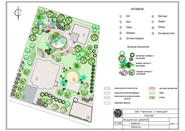
What is a layout drawing?
When carrying out improvement, landscaping and landscape design work, an important step is the development of a master plan, known as a general plan. One of the key parts of the general plan is the layout drawing (or plan), on the basis of which the project is placed on the ground.
Definition of a layout drawing
A layout drawing is one of the drawings of the general plan, which displays graphic information on the placement of designed objects and elements, taking into account the existing bases. The general plan includes the following drawings:
- relief organization plan;
- consolidated plan of utility networks and communications;
- callouts;
- site improvement plan;
- earthworks plan.
For small areas, it is possible to combine several drawings into one, and for large construction projects, on the contrary, they are divided into several parts.
Layout drawing and plan – what is the difference?
In fact, the terms “layout drawing” and “layout plan” refer to the same document. GOST uses the term “plan”, but in practice both options are equivalent and are widely used.
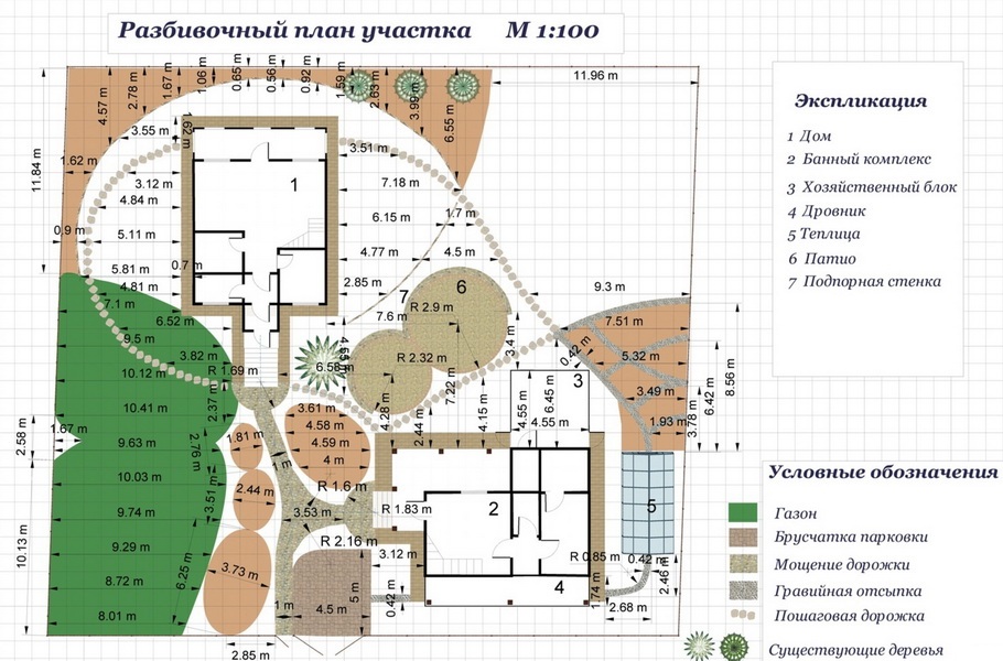
What does a layout drawing include?
A layout plan is used to accurately mark out design objects on a territory. It contains information about:
• buildings and structures (contours, intersections of axes, reference points);
• flat structures (roads, sidewalks, sites with their dimensions and radii);
• relief elements (ramps, retaining walls, drainage structures);
• small architectural forms and equipment.
In addition, the drawing includes north indicators, red lines and other conventional boundaries. The basis of a layout drawing is a geodetic grid.
Methods for creating a layout drawing
There are two main methods for creating a layout plan:
• Ordinate method – used on small areas with flat terrain. Objects are referenced by constructing perpendiculars from reference points (for example, from entrances or corners of sites).
• Square method – used for large areas. It involves creating a geodetic grid of squares, with the help of which the position of the designed objects is determined.
Although other methods exist, they are used much less frequently.
For additional information or the development of layout drawings, it is recommended to follow the standards and use specialized design software.


